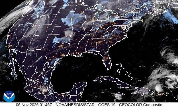
Pick a state or region to see the latest view from NOAA's GOES-East and GOES-West satellites: true-color GeoColor, infrared cloud tops, water vapor and a short loop. Imagery refreshed by our server every few hours (last check recently).
Imagery: NOAA/NESDIS/STAR, GOES ABI (public domain). Re-hosted by Ham Band Report; not an official NOAA product.
GeoColor
Daytime true color with a night-time infrared layer and city lights. Best for seeing storms, fog, smoke and snow cover. At night it shows clouds in blue-gray over the lights of towns.
Infrared (band 13, 10.3 µm)
"Clean" longwave IR shows cloud-top temperature day and night. Bright, cold colors mark tall thunderstorms; watch for rapidly cooling tops ahead of severe weather and SKYWARN activations.
Water vapor (band 09, 6.9 µm)
Mid-level moisture and the jet stream's swirls. Dry slots and troughs show the patterns that steer storm systems, and sometimes the ducting setups VHF operators watch for.
Not for safety of life. Images here can be up to a few hours old. For warnings use the National Weather Service and NOAA Weather Radio. See current alerts on our Weather page.